
Walker ZIP Code Directory: Four Postal Areas
Walker’s official ZIP map, produced in 2009, shows four postal areas serving the city: 49321, 49504, 49534, and 49544. It is an important local reference, not a street-by-street assignment list. The map is old enough that a current delivery ZIP needs an address-level USPS result. Its real value is showing why a postal overlay cannot treat four numbers as four city neighborhoods.
| ZIP | Areas Covered | Postal Label | Notes |
|---|---|---|---|
| 49321 | Northern and eastern Walker-edge service area near Grand River records | Comstock Park area designation | Test each parcel with USPS; it is not a municipal boundary. |
| 49504 | Southeast and east Walker-adjacent portion on the official map | Grand Rapids | A Grand Rapids postal line can still belong to a Walker parcel. |
| 49534 | Broad central and western service area, including the city-office mailing ZIP | Grand Rapids | Useful for mail, but not every address in the ZIP is in Walker. |
| 49544 | Northern, eastern, and industrial-corridor coverage on the official map | Grand Rapids | Use USPS to confirm an address before relying on the postal area. |
Walker’s official ZIP map supplies the mapped overlay. It does not name a separate post-office station for each row, so the postal-label column reports only the designation documented by the research. No PO-box-only or unique Walker ZIP was identified. Note: The map should be cited with its 2009 vintage whenever it is used for historical context.
Walker ZIP Postal Lines
A ZIP is a postal delivery geography. It is not a legal city limit, a parcel, a voting precinct, or a planning neighborhood. That distinction is especially important in Walker, northwest of Grand Rapids, because 49504, 49534, and 49544 use a Grand Rapids postal designation in the recorded map context. A postal city on an envelope does not prove the municipality responsible for property, court, tax, or election records.
Boundary check. Confirm the delivery ZIP with USPS, the municipality with Walker or Kent GIS, and the tax jurisdiction with the assessor. A postal label alone cannot establish where a parcel lies.
The city’s street map and Kent parcel mapping supply the geometry that a ZIP map cannot. The Walker postal reference therefore works best as a comparison tool: postal label on one side, parcel and governmental-unit fields on the other. This is a local geography issue, not a mismatch that can be fixed by changing a person’s address in a search form.
Test Walker ZIP Codes With USPS
Use the USPS lookup for the current postal answer before opening a parcel or records system. The research captured the city-and-state lookup entry point, not a live Walker result. That gap matters because the old city map does not provide a complete current street list. The USPS result can return a delivery ZIP or ZIP+4, but it should still be compared with local parcel geography.
USPS’s official lookup page is the source shown below for an address-level postal check.
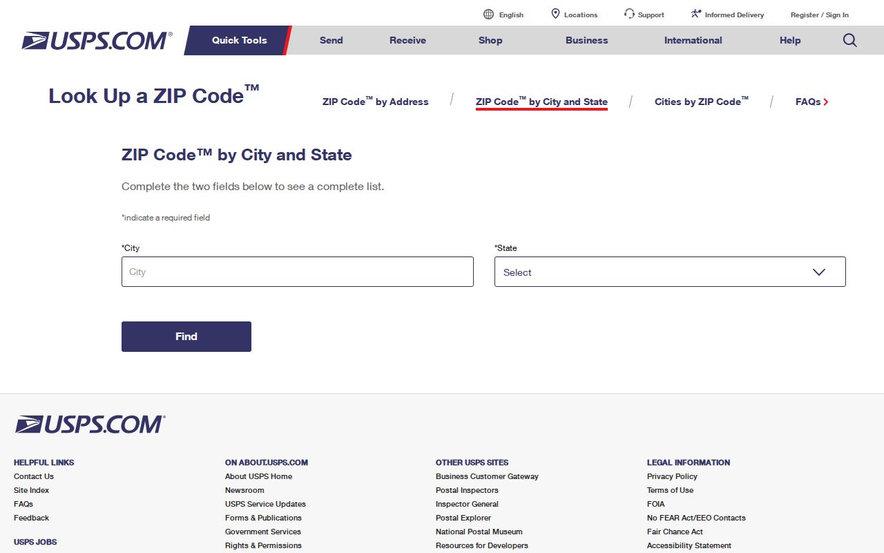
The lookup is a postal confirmation step, not a resident roster. Its captured form context supports address or city-and-state modes, and the research did not verify export, pagination, or a complete Walker result display. Save the address tested and the date of the USPS result before comparing it with a county map.
| USPS field or control | Recorded use |
|---|---|
| Address or street | Usually used for an address-level lookup. |
| City and state | Available in the city-and-state lookup context; select Michigan for a Walker search. |
| ZIP result | Returns a current delivery ZIP or ZIP+4 when a live result is available. |
| Lookup action | Interactive result; export and pagination were not verified in the research. |
Walker ZIP Fields Compared
The postal reference becomes more reliable when it joins postal information to a parcel number. Kent’s public Parcel Owner Info layer distinguishes the property-side ZIP, owner-mailing ZIP, and taxpayer-mailing ZIP. Its fields include PROPADDRESSSTATE_ZIPCODE, OWNERZIPCODE, and TAXPAYERSTATE_ZIPCODE, alongside a PPN or parcel identifier, owner-name fields, address fields, governmental unit, school district, property class, and geometry.
Those differences are a useful local quirk. A person can receive owner mail at one ZIP, taxpayer mail at another, while the property itself carries a third address field. The PPN is the stable join key when a search needs to connect the USPS result, the assessment record, and the municipal boundary. Do not merge the three address concepts into one field.
| Parcel attribute | What it describes | Why it matters for ZIP research |
|---|---|---|
| Property or situs ZIP | The parcel’s physical-address side | Compare it with the current USPS result and map geometry. |
| Owner mailing ZIP | Mailing contact for the owner field | It may differ from the parcel’s actual location. |
| Taxpayer mailing ZIP | Separate tax correspondence concept | It should not be treated as a location for the parcel. |
| PPN | Parcel number or identifier | Use it to connect local mapping and assessment sources. |
Kent’s Parcel Owner Info layer documents those fields and supports query formats, out-fields, and geometry results. Its maximum record count is 2,000, so a broad data pull should not be mistaken for a complete ZIP-wide list.
Find Walker Records by ZIP
A ZIP can narrow a record check, but the local portals do not support a verified all-purpose Walker ZIP filter. The Walker BS&A landing provides address, name, parcel, and advanced-address modes. Research did not verify a dedicated ZIP search mode for its Walker-specific session. Kent’s REST parcel layer includes ZIP attributes and can accept field queries if the service accepts the syntax, yet those results remain preliminary until parcel geometry and municipal geography are checked.
- Verify the exact address with USPS and record the delivery ZIP or ZIP+4 result date.
- Search the address, name, or parcel number in Walker BS&A or the county map, then preserve the PPN and situs field.
- Compare the PPN with Kent iMapView or the Walker REGIS planning finder to check governmental-unit geography.
- When the question becomes an address-by-address record trail, use the Walker street directory for the fuller street-level route.
Walker REGIS can search by address, parcel number, and owner name, then show parcel information, zoning districts, aerial imagery, and other layers. It adds visual context, while Walker Assessing and recorded instruments remain the channels for confirming ownership and the legal record.
Walker ZIP and Voter Scope
The Michigan Voter Information Center uses first name, last name, birth month, birth year, and ZIP in its public name workflow. It may return personal registration information such as status, clerk contact, polling place, and ballot or absentee tracking where applicable. That does not create a ZIP-wide public roster. The research did not find a public street-by-street resident list or a QVF request option defined solely by a postal ZIP.
The Michigan QVF request form instead lists one geographic scope, such as city or township, district, ward or precinct. It permits public fields including name, residential address, mailing address where available, birth year, registration date, status, voter ID, and requested voter history, while protecting other fields. Walker’s 2025 precinct update is a further reason to record a precinct version and source date rather than treating ZIP and precinct as interchangeable.
Walker ZIP Planning Areas
ZIPs, precincts, and planning clusters each describe a different kind of geography. Walker’s master-plan work groups the city into Alpine/Bristol, South Walker, Standale, and Northwest clusters, while related map material uses Northwest Edge, Northeast Side, Walker Central, and South Walker. These names help place a parcel in the city’s local geography, but they do not assign a ZIP or identify every household there.
Walker’s master-plan materials are therefore a useful comparison layer after USPS and parcel checks. The 2025 precinct change affected an electoral boundary; it did not redraw every postal boundary. Nor does a neighborhood study name, such as Alpine Estates or Cambridge Grove, prove a delivery ZIP. In Walker, postal, civic, planning, and parcel lines must be kept separate if the result is going to be accurate.
Note: Preserve the map vintage and boundary type whenever a Walker ZIP is compared with another local geography.
Walker ZIP Code Terms
Postal terms are easy to overread. A ZIP is the delivery area used in a mailing address. A ZIP+4 adds a more specific delivery segment to that ZIP. Neither term is a land description or a city-boundary finding. The official Walker map is a postal overlay, while the deed and plat record provide the legal property description when a boundary question matters.
- ZIP and ZIP+4
- A ZIP identifies a postal delivery area. ZIP+4 adds a more precise delivery segment returned by USPS for an address.
- PO-box ZIP
- A ZIP used for post-office boxes rather than a general delivery area. No Walker PO-box-only ZIP was documented in the research.
- Unique ZIP
- A ZIP assigned to one organization or facility. The research did not identify one for Walker.
- Carrier route
- A postal delivery sequence used for mail handling. It is not a municipal district, voter precinct, or parcel boundary.
- PPN
- The parcel number used in Kent parcel data. It is the stronger join key when postal and municipal geography must be compared.
Use the postal reference to start with mail geography, then let USPS, Walker or Kent GIS, and the assessor supply the separate confirmations each system can actually provide.