
Trace a Walker Street Address
A Walker street search works best as a record chain, not a name list. Walker parcel and assessing sources establish the current property association. Walker mapping tools place that parcel along the street. Recorded instruments describe transfers, while regional directories place a printed name at a Walker address in a particular year. Each Walker source answers a narrower question. Keep the owner, taxpayer, situs, mailing, and printed-directory address separate rather than treating them as one fact.
- Use the official Walker street map to preserve the exact spelling, directional suffix, and street number.
- Find the Walker parcel in Kent iMapView or Walker REGIS, then note the PPN, situs address, owner fields, mailing fields, class, acreage, and visible source date.
- Search Walker BS&A by address, then repeat the search by parcel number when a result supplies one.
- Use the current owner as a starting point in the Register of Deeds index, checking the legal description as well as the street address.
- For a dated Walker household clue, consult Grand Rapids Public Library directory volumes and reverse indexes, recording the year and the geography printed in the book.
- For an older Walker location, compare plats and historic map material before assuming a modern street label means the same place.
Ownership and recorded transfers are not the same as a complete account of who is connected with a Walker address. For a one-person question, a result needs an independent, date-specific check. For a whole Walker road, work parcel by parcel and retain a short Walker source ledger.
Walker Street Maps Start Searches
The official Walker street map supplies a street index, public landmarks, and Walker municipal geography. It is dated July 2021 and says it is not a legal document. That still makes it a useful first check when a Walker road has a directional suffix, lies near the city edge, or appears under an alternate printed form in an older source. Record the Walker map date with the spelling you use.
Walker grew from a township whose land changed through later townships and annexations before the city incorporated in 1962. Postal city labels can also point to Grand Rapids while the parcel is in Walker. Confirm the Walker municipal location with the map and parcel geometry, not only the mailing line. The Walker street map answers location questions; a plat or recorded legal description answers a boundary question.
Note: A Walker street-map result is a geographic reference, so keep its issue date beside any address conclusion drawn from it.
Walker Parcel Fields by Address
Walker Assessing maintains current ownership, assessed and taxable values, property characteristics, and market data. The Walker county parcel layer distinguishes a property or situs address from the owner mailing address and from tax-mailing data. That separation matters along a Walker street because a mailing address can be elsewhere without changing the parcel's mapped location. A PPN, or parcel number, is the strongest join between the Walker map, assessment result, and deed trail.
Walker Assessing's office page identifies the local source responsible for current property information.
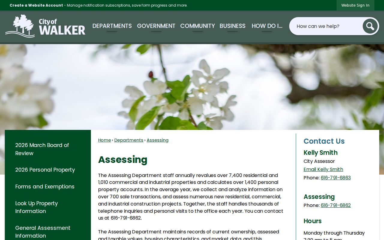
The office description supports an important Walker street-directory distinction: current assessment data identifies a property relationship, while other records are needed to date a transfer or a printed address association.
Kent iMapView and the Kent Parcel Owner Info layer provide the Walker county mapping route. The REST layer exposes PPN, owner and taxpayer fields, situs fields, class, acreage, flags, source dates, and geometry. Its maximum record count is 2,000, so a focused Walker parcel query is more dependable than treating a broad result as a complete street list.
Walker Assessing lists City Assessor Kelly Smith at 616-791-6863 and the office at 616-791-6862. The Walker office is at 4243 Remembrance Rd NW, with published hours Monday through Thursday, 7:30 a.m. to 5 p.m., and Friday, 7:30 to 11:30 a.m.
Walker Street Search Fields
The Walker BS&A portal advertises property, current-tax, sale, and building-department record searches. A full Walker-specific result screen was not captured, so the safest approach is to use the verified Walker search modes and label any field found in a live result. BS&A's generic public interface shows address, name, parcel-number, and record-number paths, including an advanced address option with number ranges.
| Walker street source | Field or control | How it narrows an address | Verified limit |
|---|---|---|---|
| BS&A | Record category | Choose All Records, Assessing, Building Department, Tax, or another listed category. | Walker result layout was not captured. |
| BS&A | Search by | Address, name, parcel number, and record-number modes guide a targeted query. | Matching behavior is not verified for Walker. |
| BS&A | Street address and number range | Use the direct address field or the advanced from/to controls. | Pagination and export are unverified. |
| Kent iMapView | Address | Search, then select the mapped parcel. | Accept its public-viewer disclaimer first. |
| Kent parcel REST | where, outFields, geometry | Filter a feature response, request fields, or use distance querying. | Syntax and query limits apply. |
| Walker REGIS | Address, parcel number, owner name | Find parcel, zoning, aerial imagery, and planning layers. | Exact live controls were not fully captured. |
Use the Walker REGIS planning finder for visual Walker zoning and aerial context, then corroborate a Walker owner or transfer with assessing and recorded instruments. A Walker map selection is a starting point, not a deed.
Walker Street Records and Access
Walker address-keyed sources do not have identical coverage or access. The table separates a public viewer from an office or request route, so a blocked Walker portal does not end the search. It also keeps a Walker property record distinct from a dated directory or recorded instrument. The Walker street directory's value comes from comparing these sources without blending their meanings.
| Address record | What it can establish | Walker or Kent access route | Important limit |
|---|---|---|---|
| Street map | Street spelling, landmarks, and city geography | Walker PDF map and index | July 2021 snapshot, not a legal survey |
| Assessment and tax record | Current owner, taxpayer, situs, value, and property facts | Walker Assessing, BS&A, or Kent parcel tools | Owner, taxpayer, and parcel addresses can differ |
| GIS parcel map | Parcel location, zoning, aerial and planning context | Kent iMapView or Walker REGIS | Layer dates and live controls vary |
| Recorded instrument | Transfer parties, recording metadata, and legal-description clues | Kent Deeds Self-Service or the Register of Deeds | The index is a finding aid; inspect the document when it matters |
| Permit or inspection record | Project address, applicant, description, valuation, and inspection trail | Walker form, city office, or a focused FOIA request | No public address-keyed history was located |
| Voter record | Specified public registration fields in an authorized request | Michigan QVF request, scoped to city or precinct where appropriate | Not an unrestricted public street list |
| Printed directory | Dated name and address association | GRPL catalog, onsite volumes, and microfilm | Year and Walker geography can have gaps |
| Plats and historic maps | Lot, subdivision, and past land context | GRPL house-history resources and physical collections | They do not establish current ownership |
Michigan voter-registration records have public and protected fields. The Qualified Voter File request form allows a Walker city or precinct scope, with delivery by pickup, FTP, or mail. It directs requests to MDOS-FOIA@michigan.gov or the Bureau of Elections mailing address listed on the form. The public self-service voter tool is a person lookup, not a Walker street-by-street directory. Do not publish protected dates of birth, contact details, identification numbers, or signatures.
Follow Walker Deeds Along Streets
When the Walker owner is unknown, the Register of Deeds directs researchers to first identify that person through Equalization or local assessing. Use the current grantee in the Walker deed index, then read the earlier instrument for the seller, recording date, document number, and legal description. Search that earlier seller as a prior grantee and repeat. This backward method follows a recorded Walker conveyance rather than assuming a street number alone remains stable.
Match the Walker parcel or lot description at every link. A trust, estate, entity, name change, or parcel split can make a simple Walker street-name search misleading. The index may expose grantor, grantee, instrument number, recording date, document type, and a legal-description reference, but the research did not verify an online cutoff year or live result layout. Request the recorded document from the office when a Walker transfer date or boundary matters.
For a historical printed-address trail, use the Walker city directory collections rather than treating a deed chain as a household directory. A criss-cross approach can connect a name and address, but it still needs the same-parcel check.
Walker Permit Records by Address
The Walker building permit application uses the Walker project address as its essential key and asks for applicant information, a project description, valuation or labor amount, a signature and date, and inspection contact. It also lists a $50 zoning permit amount where applicable under the form instructions. Those visible fields explain what an issued Walker record may contain; the form itself is not a public history database.
For issued Walker applications, inspection history, or code records, send a focused FOIA request to Community Development or the City Clerk. Name the Walker address, date range, permit type, and the fields needed. The city forms page supplies related zoning, map, and assessing material. No public Walker address-keyed code-enforcement index was located, so the specific request is the documented fallback.
Note: A permit can date city activity at an address, but it should not be used alone to claim an ownership or residence history.
Walker Street, ZIP, and City Lines
A Walker street directory comparison can go wrong when postal and municipal geography are treated as the same boundary. Walker's official 2009 ZIP map shows service areas for 49321, 49504, 49534, and 49544. The map itself is an older postal overlay, and a Grand Rapids postal city line does not establish that a parcel lies outside Walker. Use Walker municipal GIS for the jurisdiction and USPS for the current delivery result.
The PPN is the more stable link between the address, parcel geometry, assessment record, and legal description. A ZIP field in the Kent parcel service can be useful as a preliminary filter, but the research did not verify a dedicated Walker BS&A ZIP-search mode. A parcel combination or split can also change what a displayed street address appears to represent.
Walker Fire Gaps in Address Trails
Original Walker Township records were destroyed in a mid-1800s fire. That local loss is a real limitation for an early street search, not a gap to fill with a confident guess. Reconstruct an older connection through county deeds, church registers, newspapers, plats, census schedules, neighboring township material, and later histories. Walker's official history is the source for the fire and for the changes from township to city.
GRPL resources add a regional map and directory route, including Kent plats from 1855 to 2007 and directory material that reaches back to the 1850s. The Grand Rapids 1912 address key can assist metropolitan research, but it is not proof of a Walker-specific renumbering. Keep the original printed address and civil-division label in your notes until a map or plat confirms the match.
Walker Street Directory Terms
Several address terms look interchangeable but are not. Using the correct one makes a Walker street directory result easier to verify across the assessor, map, deed index, and older print sources.
- PPN or parcel number
- A parcel identifier used to connect mapped property, assessment information, and legal-description research.
- Situs address
- The physical property location carried by the parcel record, separate from an owner or taxpayer mailing address.
- Plat
- A recorded map showing a subdivision, lot, or land-division layout, useful for matching land before a familiar street address appears.
- Criss-cross directory
- A reverse address-to-name directory route that needs a year, geography check, and an independent confirmation.
A legal description is the title and boundary reference in an instrument. It can identify the same land when a street label, number, or parcel configuration has changed. Record it carefully rather than replacing it with a modern address.
Limits of a Walker Street Search
A Walker street directory cannot produce a complete list of every person associated with every address. Parcel records describe land and owner or taxpayer fields. Printed directories are dated publications. Voter information has a controlled public-field split, and the Michigan Address Confidentiality Program can supply eligible participants with a substitute address. An absent, redacted, or different address may reflect a privacy rule rather than a conclusion about a person.
Utility customer information, delivery records, many investigative materials, protected identification details, and private organization lists are not public street indexes. The Michigan Address Confidentiality Program is an official protection program, not a search source. When a public result is redacted, keep the custodian's exemption explanation and direct a narrow request to the office that holds the record.
Lawful use. Use Walker street records for personal, civic, family-history, or property research. Never use an address trail to stalk, harass, intimidate, or harm anyone.